Geodatenshop
InSAR Verschiebungsmessungen
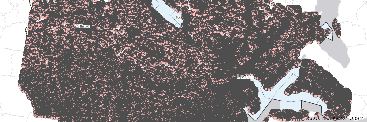
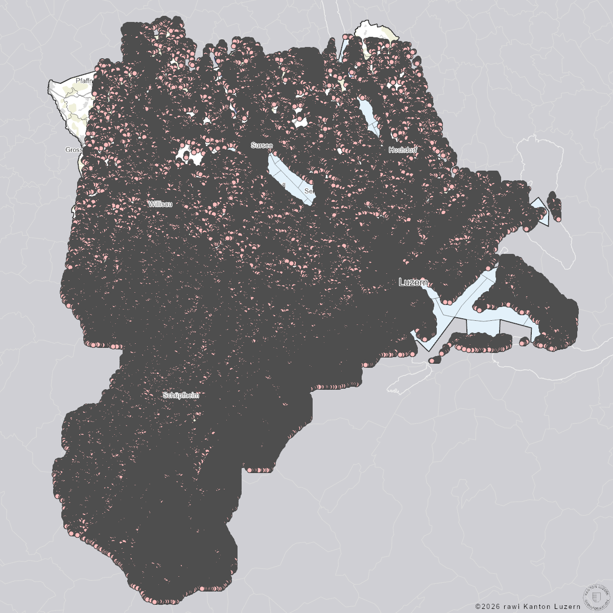
Der Datensatz enthält satellitengestützte interferometrische Verschiebungsmessungen für einzelne Bodenpunkte. Für jeden Punkt sind die mittlere jährliche Verschiebungsrate (D_RATE, [mm/Jahr]) in Blickrichtung des Sensors, sowie eine Zeitreihe der kumulierten Verschiebungen (DYYYYMMDD, [mm]) eines Bodenpunktes gegenüber dem jeweils vorangehenden Auswertungszeitpunkt verfügbar. Positive Werte bedeuten eine Bewegung eines Bodenpunktes zum Sensor hin, negative Werte bedeuten eine Bodenbewegung weg vom Sensor.
Die Auswertungen sind einzeln verfügbar für die beiden unterschiedlichen Sensoren (Radarsat-2, PALSAR-2) und für die unterschiedlichen Erdumlaufrichtungen des Satelliten (ascending, descending):
ISARIPTA_V1_PT1: PALSAR-2, Orbit D094 (descending)
ISARIPTA_V1_PT2: PALSAR-2, Orbit A199 (ascending)
ISARIPTA_V1_PT3: PALSAR-2, Orbit A199 Stripmap (ascending)
ISARIPTA_V1_PT4: Radarsat-2, Orbit T016D (descending)
ISARIPTA_V1_PT5: Radarsat-2, Orbit T309A (ascending)
Datengrundlage und Auswertungsmethodik
Die Auswertung der Bodenbewegungen basiert auf der Radarinterferometrie. Bei der Radarinterferometrie werden Phasendifferenzen zwischen der Aufnahmeposition des Satelliten und dem Bodenpunkt zu zwei Zeitpunkten ausgewertet. Diese Phasendifferenzen können in Bodenbewegungen umgerechnet werden. Für die Messung wurden SAR (Synthetic-Aperture Radar)-Satellitendaten von Radarsat-2 (C-Band) und von ALOS-2 PALSAR-2 verwendet. Für beide Sensoren sind jeweils interferometrische Auswertungen aus einem ascending Orbit (Umlaufrichtung Süd-Nord, Blickrichtung Ost-Nord-Ost) und aus einem descending Orbit (Umlaufrichtung Nord-Süd, Blickrichtung West-Nord-West) verfügbar.
Die Bewegungsmessungen basieren auf einer punktbasierten Auswertungsmethode (IPTA - Interferometric Point Target Analysis). Bei dieser Methodik wird die interferometrische Phasendifferenz nur an Bodenpunkten ermittelt, die über die Zeit eine kohärente Rückstreuung zeigen. Nur an solchen Bodenpunkten mit stabilen Rückstreueigenschaften lassen sich die Phasendifferenzen robust über die Zeit berechnen.
Interpretation der Resultate und Limitierungen
Für die Auswertung der Bodenbewegungen muss die Blickrichtung des Sensors (Ost-Nord-Ost für ascending Orbits; West-Nord-West für descending Orbits) sowie die Wellenlänge des SAR-Sensors (Radarsat-2: C-Band; ALOS-2 PALSAR-2: L-Band) berücksichtig werden.
Die gemessenen Verschiebungswerte zeigen nur die Bewegungskomponente in Blickrichtung des SAR Sensors. Die Beobachtungen geben deshalb je nach Blickrichtung des Sensors und effektiver Bewegungsrichtung des Bodens nur einen Teil der Bewegung wieder. Im Umkehrschluss bedeutet dies, dass fehlende Bewegungsmessungen nicht bedeuten, dass ein Bodenpunkt keine Bewegung erfahren hat. Bei der Interpretation der Bewegungen ist somit die Blickrichtung des Sensors unbedingt zu beachten!
Aufgrund der kürzeren Wellenlänge ist das C-Band sensitiver auf Vegetation als das L-Band. Die Rückstreuung von Bodenpunkten, welche von Vegetation bedeckt sind, ist über die Zeit nicht kohärent. Für das C-Band liegen deshalb weniger Messungen vor als für das L-Band.
Datenlieferant
Die interferometrischen Auswertungen wurden von GAMMA Remote Sensing, 3073 Gümligen, Schweiz, durchgeführt.
Dieser Mixed-Datensatz enthält 6'134'897 Objekte und wird in fünf Dateien (ISARIPTA_V1_PT2, ISARIPTA_V1_PT3, ISARIPTA_V1_PT4, ISARIPTA_V1_PT5, ISARIPTA_V1_PT1) ausgeliefert
| Dateiname: | ISARIPTA_V1_PT2 |
| Beschrieb: | PALSAR-2, Orbit A199 (ascending) |
| Inhalt: |
| Attribut | Alias (Typ) / Beschreibung |
|---|---|
D20160723 |
Aufnahmedatum 23.07.2016 (Gleitkommazahl)
|
D20160806 |
Aufnahmedatum 06.08.2016 (Gleitkommazahl)
|
D20161001 |
Aufnahmedatum 01.10.2016 (Gleitkommazahl)
|
D20170805 |
Aufnahmedatum 05.08.2017 (Gleitkommazahl)
|
D20170930 |
Aufnahmedatum 30.09.2017 (Gleitkommazahl)
|
D20150822 |
Aufnahmedatum 22.08.2015 (Gleitkommazahl)
|
D20151003 |
Aufnahmedatum 03.10.2015 (Gleitkommazahl)
|
D20180526 |
Aufnahmedatum 26.05.2018 (Gleitkommazahl)
|
D20180721 |
Aufnahmedatum 21.07.2018 (Gleitkommazahl)
|
D20180901 |
Aufnahmedatum 01.09.2018 (Gleitkommazahl)
|
D20180915 |
Aufnahmedatum 15.09.2018 (Gleitkommazahl)
|
D20181110 |
Aufnahmedatum 10.11.2018 (Gleitkommazahl)
|
D20190525 |
Aufnahmedatum 25.05.2019 (Gleitkommazahl)
|
D20190720 |
Aufnahmedatum 20.07.2019 (Gleitkommazahl)
|
D20190831 |
Aufnahmedatum 31.08.2019 (Gleitkommazahl)
|
D20190914 |
Aufnahmedatum 14.09.2019 (Gleitkommazahl)
|
D20191109 |
Aufnahmedatum 09.11.2019 (Gleitkommazahl)
|
D20200523 |
Aufnahmedatum 23.05.2020 (Gleitkommazahl)
|
D20210522 |
Aufnahmedatum 22.05.2021 (Gleitkommazahl)
|
D20210911 |
Aufnahmedatum 11.09.2021 (Gleitkommazahl)
|
D20220521 |
Aufnahmedatum 21.05.2022 (Gleitkommazahl)
|
D20230408 |
Aufnahmedatum 08.04.2023 (Gleitkommazahl)
|
D20230715 |
Aufnahmedatum 15.07.2023 (Gleitkommazahl)
|
D20240406 |
Aufnahmedatum 06.04.2024 (Gleitkommazahl)
|
D20240810 |
Aufnahmedatum 10.08.2024 (Gleitkommazahl)
|
D_RATE |
Mittl. jährl. Verschiebung in Blickrichtung [mm] (Gleitkommazahl)
|
DEF_UNC |
Geschätzte Unsicherheit Deformationsrate [mm/a] (Gleitkommazahl)
|
ELEV |
Topographische Höhe des Punktes [m] (Gleitkommazahl)
|
ELEV_UNC |
Unsicherheit interferometr. Höhenbestimmung [m] (Gleitkommazahl)
|
IMG_X |
x Pixel im Referenzbild (Radarkoordinaten) (ganze Zahl)
|
IMG_Y |
y Pixel im Referenzbild (Radarkoordinaten) (ganze Zahl)
|
P_NR |
Punktidentifikationsnummer (ganze Zahl)
|
Shape |
Shape (Se Shape Type)
|
STDDEV |
Standardabweichung der Restphase [rad] (Gleitkommazahl)
|
| Dateiname: | ISARIPTA_V1_PT3 |
| Beschrieb: | PALSAR-2, Orbit A199 Stripmap (ascending) |
| Inhalt: |
| Attribut | Alias (Typ) / Beschreibung |
|---|---|
D20150822 |
Aufnahmedatum 22.08.2015 (Gleitkommazahl)
|
D20151003 |
Aufnahmedatum 03.10.2015 (Gleitkommazahl)
|
D20160723 |
Aufnahmedatum 23.07.2016 (Gleitkommazahl)
|
D20160806 |
Aufnahmedatum 06.08.2016 (Gleitkommazahl)
|
D20161001 |
Aufnahmedatum 01.10.2016 (Gleitkommazahl)
|
D20170805 |
Aufnahmedatum 05.08.2017 (Gleitkommazahl)
|
D20170930 |
Aufnahmedatum 30.09.2017 (Gleitkommazahl)
|
D20180526 |
Aufnahmedatum 26.05.2018 (Gleitkommazahl)
|
D20180721 |
Aufnahmedatum 21.07.2018 (Gleitkommazahl)
|
D20180901 |
Aufnahmedatum 01.09.2018 (Gleitkommazahl)
|
D20180915 |
Aufnahmedatum 15.09.2018 (Gleitkommazahl)
|
D20181110 |
Aufnahmedatum 10.11.2018 (Gleitkommazahl)
|
D20190525 |
Aufnahmedatum 25.05.2019 (Gleitkommazahl)
|
D20190720 |
Aufnahmedatum 20.07.2019 (Gleitkommazahl)
|
D20190831 |
Aufnahmedatum 31.08.2019 (Gleitkommazahl)
|
D20190914 |
Aufnahmedatum 14.09.2019 (Gleitkommazahl)
|
D20191109 |
Aufnahmedatum 09.11.2019 (Gleitkommazahl)
|
D20200523 |
Aufnahmedatum 23.05.2020 (Gleitkommazahl)
|
D20210522 |
Aufnahmedatum 22.05.2021 (Gleitkommazahl)
|
D20210911 |
Aufnahmedatum 11.09.2021 (Gleitkommazahl)
|
D20220521 |
Aufnahmedatum 21.05.2022 (Gleitkommazahl)
|
D20230408 |
Aufnahmedatum 08.04.2023 (Gleitkommazahl)
|
D20230715 |
Aufnahmedatum 15.07.2023 (Gleitkommazahl)
|
D20240406 |
Aufnahmedatum 06.04.2024 (Gleitkommazahl)
|
D20240810 |
Aufnahmedatum 10.08.2024 (Gleitkommazahl)
|
D_RATE |
Mittl. jährl. Verschiebung in Blickrichtung [mm] (Gleitkommazahl)
|
DEF_UNC |
Geschätzte Unsicherheit Deformationsrate [mm/a] (Gleitkommazahl)
|
ELEV |
Topographische Höhe des Punktes [m] (Gleitkommazahl)
|
ELEV_UNC |
Unsicherheit interferometr. Höhenbestimmung [m] (Gleitkommazahl)
|
IMG_X |
x Pixel im Referenzbild (Radarkoordinaten) (ganze Zahl)
|
IMG_Y |
y Pixel im Referenzbild (Radarkoordinaten) (ganze Zahl)
|
P_NR |
Punktidentifikationsnummer (ganze Zahl)
|
Shape |
Shape (Se Shape Type)
|
STDDEV |
Standardabweichung der Restphase [rad] (Gleitkommazahl)
|
| Dateiname: | ISARIPTA_V1_PT4 |
| Beschrieb: | Radarsat-2, Orbit T016D (descending) |
| Inhalt: |
| Attribut | Alias (Typ) / Beschreibung |
|---|---|
D20160717 |
Aufnahmedatum 17.07.2016 (Gleitkommazahl)
|
D20160810 |
Aufnahmedatum 10.08.2016 (Gleitkommazahl)
|
D20160903 |
Aufnahmedatum 03.09.2016 (Gleitkommazahl)
|
D20160927 |
Aufnahmedatum 27.09.2016 (Gleitkommazahl)
|
D20161021 |
Aufnahmedatum 21.10.2016 (Gleitkommazahl)
|
D20170525 |
Aufnahmedatum 25.05.2017 (Gleitkommazahl)
|
D20170618 |
Aufnahmedatum 18.06.2017 (Gleitkommazahl)
|
D20170712 |
Aufnahmedatum 12.07.2017 (Gleitkommazahl)
|
D20170805 |
Aufnahmedatum 05.08.2017 (Gleitkommazahl)
|
D20170829 |
Aufnahmedatum 29.08.2017 (Gleitkommazahl)
|
D20170922 |
Aufnahmedatum 22.09.2017 (Gleitkommazahl)
|
D20171016 |
Aufnahmedatum 16.10.2017 (Gleitkommazahl)
|
D20180520 |
Aufnahmedatum 20.05.2018 (Gleitkommazahl)
|
D20180613 |
Aufnahmedatum 13.06.2018 (Gleitkommazahl)
|
D20180707 |
Aufnahmedatum 07.07.2018 (Gleitkommazahl)
|
D20180731 |
Aufnahmedatum 31.07.2018 (Gleitkommazahl)
|
D20180824 |
Aufnahmedatum 24.08.2018 (Gleitkommazahl)
|
D20180917 |
Aufnahmedatum 17.09.2018 (Gleitkommazahl)
|
D20181011 |
Aufnahmedatum 11.10.2018 (Gleitkommazahl)
|
D20181104 |
Aufnahmedatum 04.11.2018 (Gleitkommazahl)
|
D20181128 |
Aufnahmedatum 28.11.2018 (Gleitkommazahl)
|
D20190515 |
Aufnahmedatum 15.05.2019 (Gleitkommazahl)
|
D20190608 |
Aufnahmedatum 08.06.2019 (Gleitkommazahl)
|
D20190702 |
Aufnahmedatum 02.07.2019 (Gleitkommazahl)
|
D20190819 |
Aufnahmedatum 19.08.2019 (Gleitkommazahl)
|
D20190912 |
Aufnahmedatum 12.09.2019 (Gleitkommazahl)
|
D20191006 |
Aufnahmedatum 06.10.2019 (Gleitkommazahl)
|
D20191030 |
Aufnahmedatum 30.10.2019 (Gleitkommazahl)
|
D20191123 |
Aufnahmedatum 23.11.2019 (Gleitkommazahl)
|
D20200509 |
Aufnahmedatum 09.05.2020 (Gleitkommazahl)
|
D20200602 |
Aufnahmedatum 02.06.2020 (Gleitkommazahl)
|
D20200626 |
Aufnahmedatum 26.06.2020 (Gleitkommazahl)
|
D20200720 |
Aufnahmedatum 20.07.2020 (Gleitkommazahl)
|
D20200813 |
Aufnahmedatum 13.08.2020 (Gleitkommazahl)
|
D20200930 |
Aufnahmedatum 30.09.2020 (Gleitkommazahl)
|
D20201024 |
Aufnahmedatum 24.10.2020 (Gleitkommazahl)
|
D20201117 |
Aufnahmedatum 17.11.2020 (Gleitkommazahl)
|
D20210528 |
Aufnahmedatum 28.05.2021 (Gleitkommazahl)
|
D20210621 |
Aufnahmedatum 21.06.2021 (Gleitkommazahl)
|
D20210715 |
Aufnahmedatum 15.07.2021 (Gleitkommazahl)
|
D20210808 |
Aufnahmedatum 08.08.2021 (Gleitkommazahl)
|
D20210901 |
Aufnahmedatum 01.09.2021 (Gleitkommazahl)
|
D20210925 |
Aufnahmedatum 25.09.2021 (Gleitkommazahl)
|
D20211019 |
Aufnahmedatum 19.10.2021 (Gleitkommazahl)
|
D20211112 |
Aufnahmedatum 12.11.2021 (Gleitkommazahl)
|
D20220616 |
Aufnahmedatum 16.06.2022 (Gleitkommazahl)
|
D20220710 |
Aufnahmedatum 10.07.2022 (Gleitkommazahl)
|
D20220803 |
Aufnahmedatum 03.08.2022 (Gleitkommazahl)
|
D20220827 |
Aufnahmedatum 27.08.2022 (Gleitkommazahl)
|
D20220920 |
Aufnahmedatum 20.09.2022 (Gleitkommazahl)
|
D20221014 |
Aufnahmedatum 14.10.2022 (Gleitkommazahl)
|
D20230611 |
Aufnahmedatum 11.06.2023 (Gleitkommazahl)
|
D20230705 |
Aufnahmedatum 05.07.2023 (Gleitkommazahl)
|
D20230729 |
Aufnahmedatum 29.07.2023 (Gleitkommazahl)
|
D20230822 |
Aufnahmedatum 22.08.2023 (Gleitkommazahl)
|
D20230915 |
Aufnahmedatum 15.09.2023 (Gleitkommazahl)
|
D20231009 |
Aufnahmedatum 09.10.2023 (Gleitkommazahl)
|
D20231102 |
Aufnahmedatum 02.11.2023 (Gleitkommazahl)
|
D_RATE |
Mittl. jährl. Verschiebung in Blickrichtung [mm] (Gleitkommazahl)
|
DEF_UNC |
Geschätzte Unsicherheit Deformationsrate [mm/a] (Gleitkommazahl)
|
ELEV |
Topographische Höhe des Punktes [m] (Gleitkommazahl)
|
ELEV_UNC |
Unsicherheit interferometr. Höhenbestimmung [m] (Gleitkommazahl)
|
IMG_X |
x Pixel im Referenzbild (Radarkoordinaten) (ganze Zahl)
|
IMG_Y |
y Pixel im Referenzbild (Radarkoordinaten) (ganze Zahl)
|
P_NR |
Punktidentifikationsnummer (ganze Zahl)
|
Shape |
Shape (Se Shape Type)
|
STDDEV |
Standardabweichung der Restphase [rad] (Gleitkommazahl)
|
| Dateiname: | ISARIPTA_V1_PT5 |
| Beschrieb: | Radarsat-2, Orbit T309A (ascending) |
| Inhalt: |
| Attribut | Alias (Typ) / Beschreibung |
|---|---|
D20160526 |
Aufnahmedatum 26.05.2016 (Gleitkommazahl)
|
D20160619 |
Aufnahmedatum 19.06.2016 (Gleitkommazahl)
|
D20160713 |
Aufnahmedatum 13.07.2016 (Gleitkommazahl)
|
D20160806 |
Aufnahmedatum 06.08.2016 (Gleitkommazahl)
|
D20160830 |
Aufnahmedatum 30.08.2016 (Gleitkommazahl)
|
D20160923 |
Aufnahmedatum 23.09.2016 (Gleitkommazahl)
|
D20161017 |
Aufnahmedatum 17.10.2016 (Gleitkommazahl)
|
D20170521 |
Aufnahmedatum 21.05.2017 (Gleitkommazahl)
|
D20170614 |
Aufnahmedatum 14.06.2017 (Gleitkommazahl)
|
D20170708 |
Aufnahmedatum 08.07.2017 (Gleitkommazahl)
|
D20170801 |
Aufnahmedatum 01.08.2017 (Gleitkommazahl)
|
D20170825 |
Aufnahmedatum 25.08.2017 (Gleitkommazahl)
|
D20170918 |
Aufnahmedatum 18.09.2017 (Gleitkommazahl)
|
D20171012 |
Aufnahmedatum 12.10.2017 (Gleitkommazahl)
|
D20180516 |
Aufnahmedatum 16.05.2018 (Gleitkommazahl)
|
D20180609 |
Aufnahmedatum 09.06.2018 (Gleitkommazahl)
|
D20180703 |
Aufnahmedatum 03.07.2018 (Gleitkommazahl)
|
D20180727 |
Aufnahmedatum 27.07.2018 (Gleitkommazahl)
|
D20180820 |
Aufnahmedatum 20.08.2018 (Gleitkommazahl)
|
D20180913 |
Aufnahmedatum 13.09.2018 (Gleitkommazahl)
|
D20181007 |
Aufnahmedatum 07.10.2018 (Gleitkommazahl)
|
D20181031 |
Aufnahmedatum 31.10.2018 (Gleitkommazahl)
|
D20181124 |
Aufnahmedatum 24.11.2018 (Gleitkommazahl)
|
D20190511 |
Aufnahmedatum 11.05.2019 (Gleitkommazahl)
|
D20190604 |
Aufnahmedatum 04.06.2019 (Gleitkommazahl)
|
D20190628 |
Aufnahmedatum 28.06.2019 (Gleitkommazahl)
|
D20190722 |
Aufnahmedatum 22.07.2019 (Gleitkommazahl)
|
D20190815 |
Aufnahmedatum 15.08.2019 (Gleitkommazahl)
|
D20190908 |
Aufnahmedatum 08.09.2019 (Gleitkommazahl)
|
D20191026 |
Aufnahmedatum 26.10.2019 (Gleitkommazahl)
|
D20200505 |
Aufnahmedatum 05.05.2020 (Gleitkommazahl)
|
D20200529 |
Aufnahmedatum 29.05.2020 (Gleitkommazahl)
|
D20200622 |
Aufnahmedatum 22.06.2020 (Gleitkommazahl)
|
D20200716 |
Aufnahmedatum 16.07.2020 (Gleitkommazahl)
|
D20200809 |
Aufnahmedatum 09.08.2020 (Gleitkommazahl)
|
D20200902 |
Aufnahmedatum 02.09.2020 (Gleitkommazahl)
|
D20200926 |
Aufnahmedatum 26.09.2020 (Gleitkommazahl)
|
D20201020 |
Aufnahmedatum 20.10.2020 (Gleitkommazahl)
|
D20201113 |
Aufnahmedatum 13.11.2020 (Gleitkommazahl)
|
D20210524 |
Aufnahmedatum 24.05.2021 (Gleitkommazahl)
|
D20210617 |
Aufnahmedatum 17.06.2021 (Gleitkommazahl)
|
D20210711 |
Aufnahmedatum 11.07.2021 (Gleitkommazahl)
|
D20210804 |
Aufnahmedatum 04.08.2021 (Gleitkommazahl)
|
D20210828 |
Aufnahmedatum 28.08.2021 (Gleitkommazahl)
|
D20210921 |
Aufnahmedatum 21.09.2021 (Gleitkommazahl)
|
D20211015 |
Aufnahmedatum 15.10.2021 (Gleitkommazahl)
|
D20211108 |
Aufnahmedatum 08.11.2021 (Gleitkommazahl)
|
D20220706 |
Aufnahmedatum 06.07.2022 (Gleitkommazahl)
|
D20220730 |
Aufnahmedatum 30.07.2022 (Gleitkommazahl)
|
D20220823 |
Aufnahmedatum 23.08.2022 (Gleitkommazahl)
|
D20220916 |
Aufnahmedatum 16.09.2022 (Gleitkommazahl)
|
D20221010 |
Aufnahmedatum 10.10.2022 (Gleitkommazahl)
|
D20221103 |
Aufnahmedatum 03.11.2022 (Gleitkommazahl)
|
D20230607 |
Aufnahmedatum 07.06.2023 (Gleitkommazahl)
|
D20230701 |
Aufnahmedatum 01.07.2023 (Gleitkommazahl)
|
D20230725 |
Aufnahmedatum 25.07.2023 (Gleitkommazahl)
|
D20230818 |
Aufnahmedatum 18.08.2023 (Gleitkommazahl)
|
D20230911 |
Aufnahmedatum 11.09.2023 (Gleitkommazahl)
|
D20231005 |
Aufnahmedatum 05.10.2023 (Gleitkommazahl)
|
D20231029 |
Aufnahmedatum 29.10.2023 (Gleitkommazahl)
|
D_RATE |
Mittl. jährl. Verschiebung in Blickrichtung [mm] (Gleitkommazahl)
|
DEF_UNC |
Geschätzte Unsicherheit Deformationsrate [mm/a] (Gleitkommazahl)
|
ELEV |
Topographische Höhe des Punktes [m] (Gleitkommazahl)
|
ELEV_UNC |
Unsicherheit interferometr. Höhenbestimmung [m] (Gleitkommazahl)
|
IMG_X |
x Pixel im Referenzbild (Radarkoordinaten) (ganze Zahl)
|
IMG_Y |
y Pixel im Referenzbild (Radarkoordinaten) (ganze Zahl)
|
P_NR |
Punktidentifikationsnummer (ganze Zahl)
|
Shape |
Shape (Se Shape Type)
|
STDDEV |
Standardabweichung der Restphase [rad] (Gleitkommazahl)
|
| Dateiname: | ISARIPTA_V1_PT1 |
| Beschrieb: | PALSAR-2, Orbit D094 (descending) |
| Inhalt: |
| Attribut | Alias (Typ) / Beschreibung |
|---|---|
D20201003 |
Aufnahmedatum 03.10.2020 (Gleitkommazahl)
|
D20211113 |
Aufnahmedatum 13.11.2021 (Gleitkommazahl)
|
D20220625 |
Aufnahmedatum 25.06.2022 (Gleitkommazahl)
|
D20220820 |
Aufnahmedatum 20.08.2022 (Gleitkommazahl)
|
D20220917 |
Aufnahmedatum 17.09.2022 (Gleitkommazahl)
|
D20221001 |
Aufnahmedatum 01.10.2022 (Gleitkommazahl)
|
D20221015 |
Aufnahmedatum 15.10.2022 (Gleitkommazahl)
|
D20221112 |
Aufnahmedatum 12.11.2022 (Gleitkommazahl)
|
D20230902 |
Aufnahmedatum 02.09.2023 (Gleitkommazahl)
|
D20240706 |
Aufnahmedatum 06.07.2024 (Gleitkommazahl)
|
D20240817 |
Aufnahmedatum 17.08.2024 (Gleitkommazahl)
|
D20240928 |
Aufnahmedatum 28.09.2024 (Gleitkommazahl)
|
D_RATE |
Mittl. jährl. Verschiebung in Blickrichtung [mm] (Gleitkommazahl)
|
DEF_UNC |
Geschätzte Unsicherheit Deformationsrate [mm/a] (Gleitkommazahl)
|
ELEV |
Topographische Höhe des Punktes [m] (Gleitkommazahl)
|
ELEV_UNC |
Unsicherheit interferometr. Höhenbestimmung [m] (Gleitkommazahl)
|
IMG_X |
x Pixel im Referenzbild (Radarkoordinaten) (ganze Zahl)
|
IMG_Y |
y Pixel im Referenzbild (Radarkoordinaten) (ganze Zahl)
|
P_NR |
Punktidentifikationsnummer (ganze Zahl)
|
Shape |
Shape (Se Shape Type)
|
STDDEV |
Standardabweichung der Restphase [rad] (Gleitkommazahl)
|
D20150523 |
Aufnahmedatum 23.05.2015 (Gleitkommazahl)
|
D20150704 |
Aufnahmedatum 04.07.2015 (Gleitkommazahl)
|
D20150801 |
Aufnahmedatum 01.08.2015 (Gleitkommazahl)
|
D20150912 |
Aufnahmedatum 12.09.2015 (Gleitkommazahl)
|
D20151024 |
Aufnahmedatum 24.10.2015 (Gleitkommazahl)
|
D20160521 |
Aufnahmedatum 21.05.2016 (Gleitkommazahl)
|
D20160730 |
Aufnahmedatum 30.07.2016 (Gleitkommazahl)
|
D20160910 |
Aufnahmedatum 10.09.2016 (Gleitkommazahl)
|
D20161022 |
Aufnahmedatum 22.10.2016 (Gleitkommazahl)
|
D20170701 |
Aufnahmedatum 01.07.2017 (Gleitkommazahl)
|
D20170729 |
Aufnahmedatum 29.07.2017 (Gleitkommazahl)
|
D20191005 |
Aufnahmedatum 05.10.2019 (Gleitkommazahl)
|
letzte Aktualisierung dieser Seite (Stand der Metadaten): 05.03.2026